Background
The A379 Bridge Road fulfils several strategic and local functions:
- A high volume traffic road on the local road network as one of the 3 main crossings of the river Exe;
- A “Main” road in the subregional network connecting to the Strategic Road Network, therefore classified nationally as part of the Major Road Network;
- An important diversionary and overflow route for the M5 viaduct between junction 30 and 31 of the M5;
- A key bus corridor carrying several bus routes connecting Exeter to local Market towns and Plymouth; and
- A component of several local and strategic cycle routes (both crossing the road and running parallel to it).
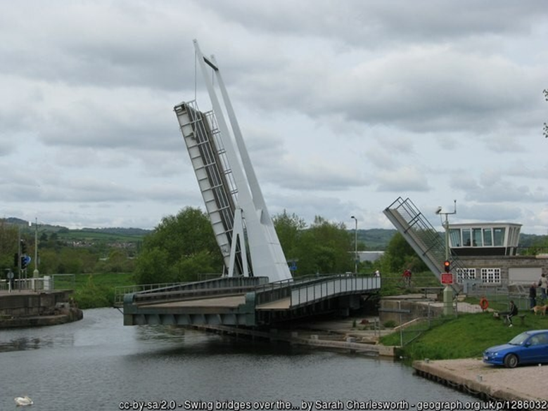
However, the bascule (lifting) and swing bridges carrying the road over the Exeter Ship Canal are approaching the end of their lifespan, of limited width and are deteriorating, reducing the resilience of this key strategic link. When faults occur, or when the bridges are opened to allow vessels to travel along the canal, there is extensive disruption on the local road network, with associated social and economic impacts.
The pedestrian/cycle crossings of Bridge Road are at-grade, causing delays to both non-motorised users and vehicular traffic, and creating conflict between pedestrians, cyclists and road traffic.
In summary, a scheme has been developed to replace or refurbish the canal bridges, to provide an operational lifespan of at least 60 years. It is also proposed to:
- Improve the existing walking and cycling facilities in the area
- Provide a bus stop on the northbound side of Bridge Road, approximately opposite to the existing southbound bus stop.