Type: Pop-up cycleway (including point closures, one way route with contraflow, widened footways)
Description: Creation of pop up cycleway connecting over 50,000 jobs at city centre, County Hall, Hospital, Pynes Hill and Sowton. 4km quiet route created by removing through traffic on number of streets, by the following measures:
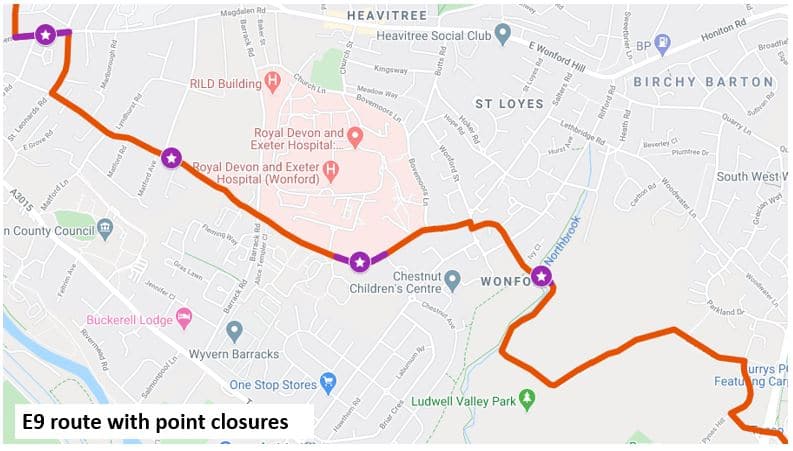
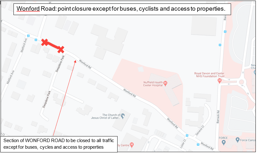
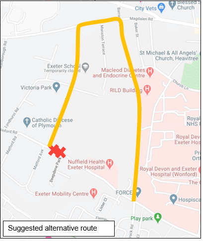
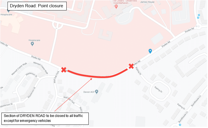
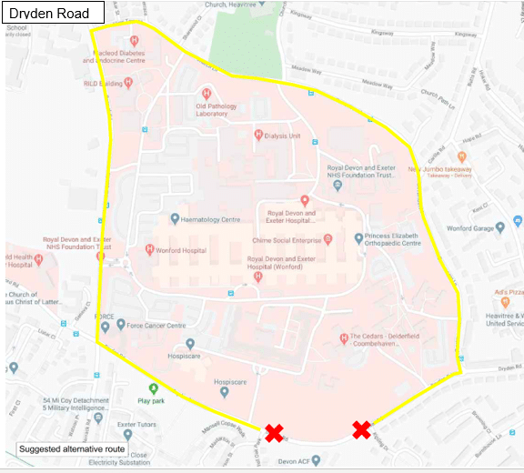
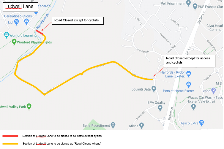
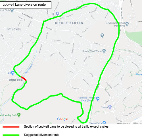
- 3 Point Closures at Wonford Rd, Dryden Rd, Ludwell Lane. Implementation date 05 June 2020, see the maps below for detail.
Wonford Road
Dryden Road
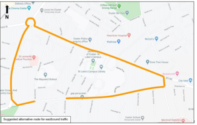
Ludwell Lane
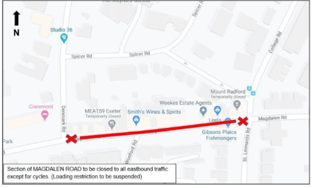
- Magdalen Road one way street with contraflow cycleway and widened footway. Implementation date 10 June 2020, see map below for detail.
- Point closure on Kestrel Way. Further information to follow.