Aerial Investigation and Mapping (AI&M) methodology has been developed by English Heritage (now Historic England) for identifying, mapping and recording archaeological sites and landscapes from aerial photographs and other airborne remote sensed data such as lidar. It was previously known as the National Mapping Programme (NMP).
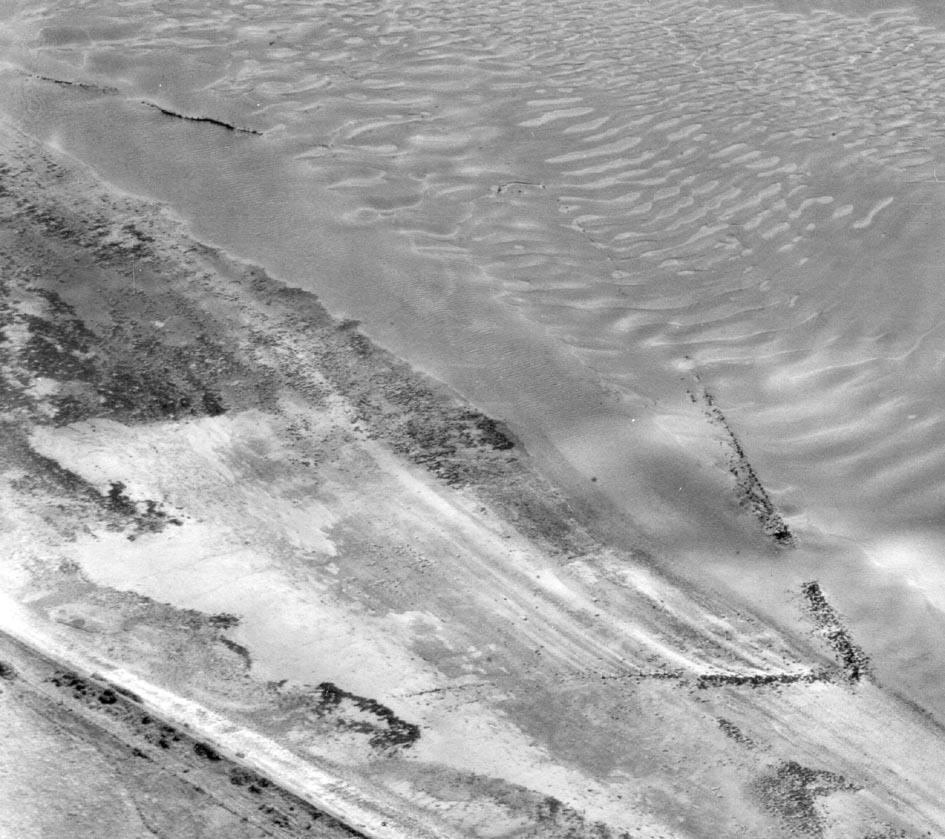
 Valuable potential historic environment information is contained within aerial photographs for periods from the Neolithic period to the Cold War. It can be seen above the ground as earthworks or structures and buried remains can be revealed as cropmarks or soilmarks.
Millions of aerial photographs are held for England by archives such as the Historic England Archive, Cambridge University and local sources such as the Historic Environment Record (HER).
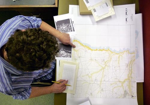
 The AI&M methodology and standards developed by English Heritage (now Historic England) provide the means for expert aerial photograph interpreters to interpret and record this information to a consistent standard. Each AI&M project examines all readily available aerial photographs and remote sensing data for a specified area. Depending on this size of the project area, this can easily number into the tens of thousands of aerial photographs.
The best way to provide a synthesis of such a large amount of archaeological information is in the form of a map, with accompanying descriptions of all recorded sites and landscapes in the HER.
 In this way, the AI&M projects enhance our understanding of past land use through identification and analysis of previously unrecorded archaeological landscapes and improving the information held for monuments already recorded on the HER. This information can then be used by Devon County Council Historic Environment team for research and management of change in the historic environment.
Several AI&M projects have surveyed areas of Devon and project highlight reports can be downloaded from Historic England webpages.
- South Devon Coast to Dartmoor, Haldon to Dart and Avon to Plymouth. Summary results from two completed areas are on the Haldon Ridge and the Dart Valley and Plymouth to the Avon Valley AI&M Project page.
- Blackdown Hills AONB. Summaries of the main themes are on the Blackdown Hills Aerial Investigation and Mapping Project page.
- East and Mid Devon River Catchments. Also, illustrated summaries of the main themes can be viewed on the East and Mid Devon Rivers Catchments NMP Project page.
- South Devon Coast RCZAS. Also, illustrated summaries of the main themes are also available on the South Devon Rapid Coastal Zone Assessment NMP Project page.
- North Devon Coast AONB. Also, illustrated summaries of the main themes are also available on the North Devon Coast AONB NMP Project page.
- North Devon.
- Dartmoor. Please contact Dartmoor National Park for information regarding this survey.
- Exmoor falls partly within Devon. Please contact Exmoor National Park for information regarding this survey.
More recently the Historic Environment team has been working with Historic England, AC Archaeology and the University of Exeter to survey the Tamar Valley. This project focused on interpretation of lidar data to supplement the sites previously mapped from aerial photographs, and incorporates data from the Understanding Landscapes project volunteers. You can read a summary of the results on the Tamar Lidar page.
The most recent project was a rapid assessment of specially flown lidar data within the East Devon Area of Outstanding Natural Beauty, undertaken by AC Archaeology and funded by the East Devon AONB Partnership and Devon County Council. The final report will be made available on ads.
The information generated by these projects is on the HER, which can be accessed via Heritage Gateway and the Devon Environment Viewer.
More information on Aerial Investigation and Mapping can be found on Historic England’s webpages.