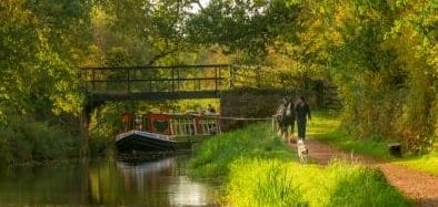
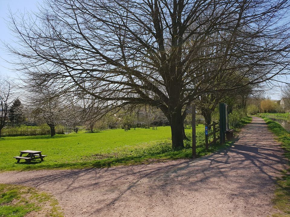
The Grand Western Canal Country Park has dozens of access points, with several car parks and lay-bys dotted along its length that provide easy access onto the towpath. View the Canal Country Park map and plan your visit.
Here is a list of some of the areas within the Country Park that you may wish to visit:
-
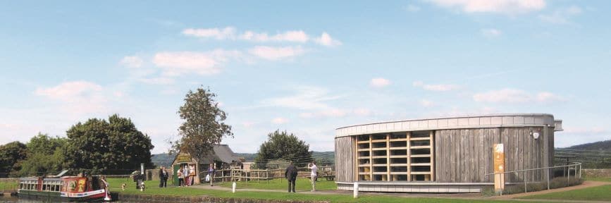
Canal Basin, Tiverton

The Canal Basin in Tiverton represents the south-western terminus of the Canal. It is the main gateway for the Country Park comprising of a large pay and display car park, Canal Visitor Centre, cafes and tea rooms, a gift shop, boat hire facilities, children’s play park and the Canal Ranger Service offices. Public toilets are located near the entrance to this car park.
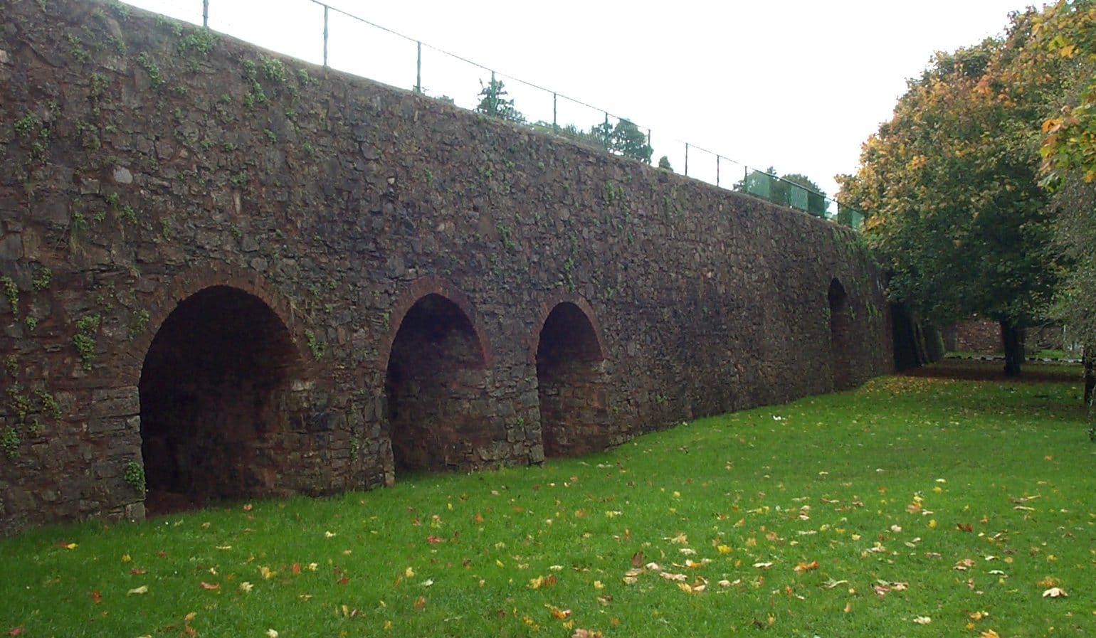
 The Canal Basin can be accessed from the car park by steps or by the ramps provided at either end of the car park. But before you head up, maybe take a moment to notice the archways in the walls beside the car park – they give a clue as to the original reason for canal’s construction. Above each archway was a limekiln and the main cargo on the Grand Western Canal was limestone which was brought to these limekilns to be burnt. You can discover more about this process and see inside the last remaining open kiln at the top of the steps. The lime kiln complex is Grade II-listed, and the long stretch of original stone wall which retains the lime kilns is a key feature of the Canal Basin landscape.
The Canal Visitor Centre has a range of fascinating displays about the Canal’s turbulent history, its stunning wildlife and information about the range of activities you can enjoy. It also has lots of hands on activities and games for children and adults alike and is a great place to start your journey along this beautiful canal.
It is also home to the Tiverton Canal Co which runs the horse drawn barge, canoe and rowing boat hire, the Old Stable gift shop and the floating Ducks Ditty Café-Bar.
The Canal Tea Rooms and Garden is also located at the end of the car park.
-
William Authers Footbridge

William Authers Foot Bridge was built as a pedestrian walkway to connect Spurway Road to the Wilcombe housing estate. Named after a late local councillor, William Authers, who was a key figure in saving the canal from being in-filled in the 1960s.
-
Tidcombe Bridge
At Tidcombe Bridge, on the offside you will see Tidcombe Hall. This early 19th century house, was formally Tidcombe Rectory and built by a former rector, Rev. John Newte.

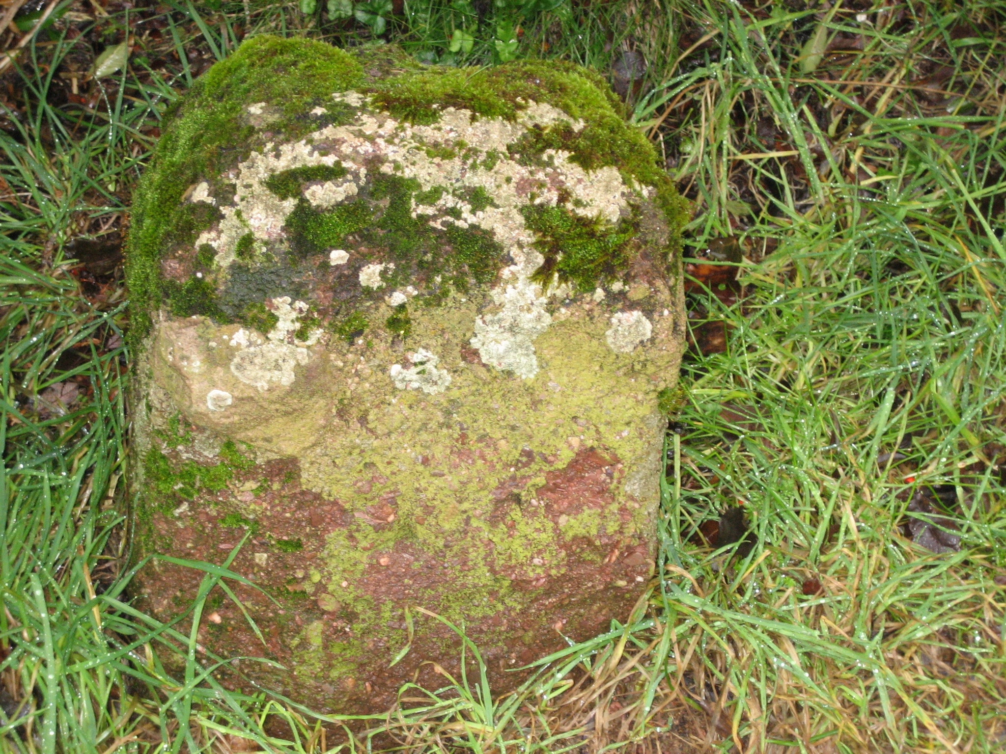
Milestone 1 – This distance marker is part of the Canal’s heritage as it would have been installed when they built the canal. Beyond this on the towpath side, the canal enters mixed farmland and takes on a distinctly rural and more natural landscape, with pleasant views to surrounding hills.
-
Warnicombe Bridge / Snakes Wood

Particular features in this section are the mature oak trees, and the short, wooded section (on both sides) of Snakes Wood itself. Most of this wood lies to the south of the canal, is privately owned and is a County Wildlife Site. It has a secretive and enclosed feel which contrasts with the more open landscape at either end.
-
Manley Bridge
As you approach Manley Bridge there is the Canberra Bomber Memorial Panel, this gives details of how dredging works in 2003 turned up the remains of a Canberra bomber that had crashed into the canal in 1961 on a training flight from Germany.
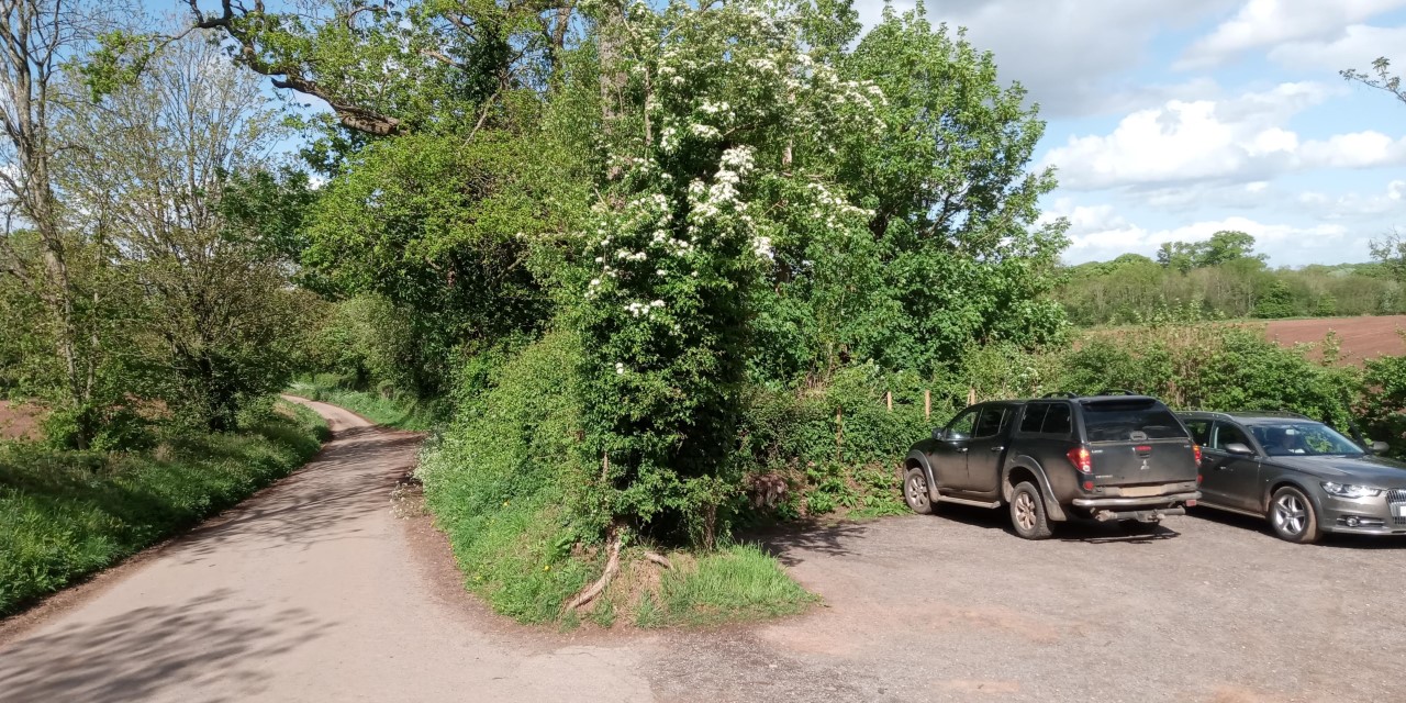
 A small car park is situated next to Manley Bridge. This section is very popular with local residents and forms part of a circular walk, known as The Old Railway Walk, which loops from the Canal Basin to Manley Bridge and joins the old railway track that the much loved ‘Tivvy Bumper’ (Great Western Railway engine No. 1442) once ran along. The line, opened in 1848, ran from Tiverton Junction on the main Bristol – Exeter line through to Tiverton on the Exe Valley line. The coming of the railways however put the Canal out of business. The railway was then also made redundant during the Beeching cuts. The ‘Tivvy Bumper’ now rests at the Tiverton Museum in St. Andrew’s Street.
 -
East Manley Bridge

Things to look out for: Milestone 2, Barges moored at Mid Devon Moorings
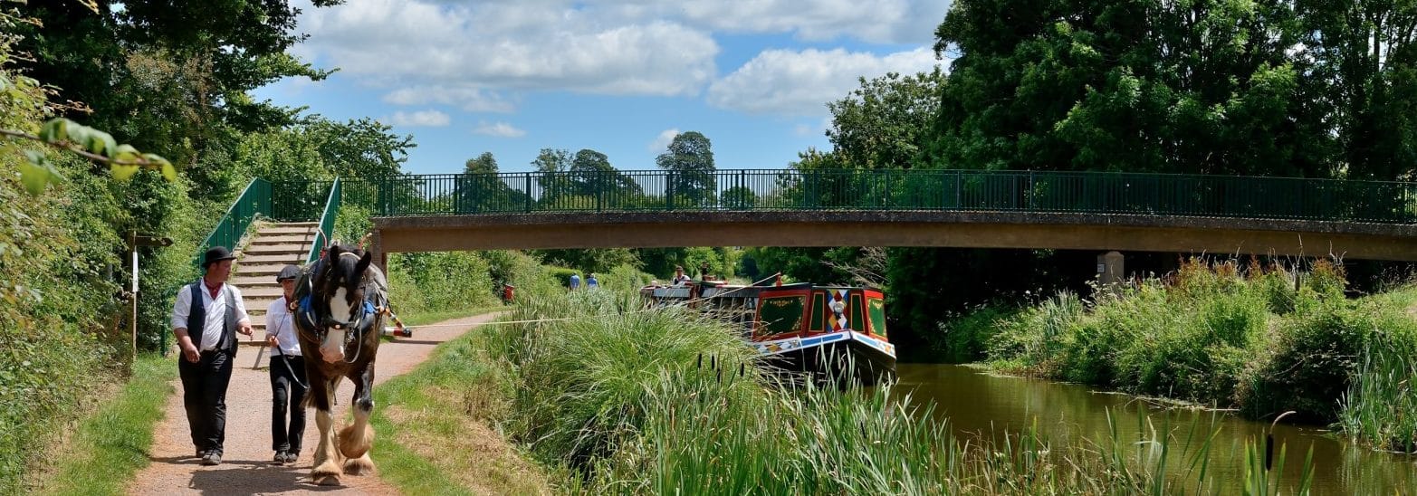
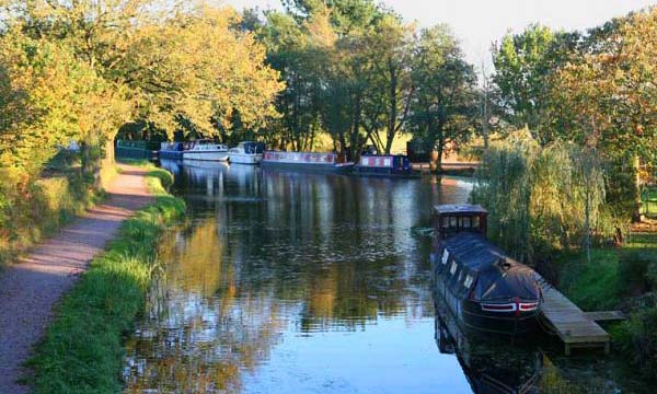
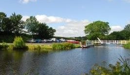
Mid Devon Moorings (formally Mid Devon Hire Boats & Moorings) have a number of beautiful moorings on the Grand Western Canal located near East Manley bridge and have been welcoming craft here since 2004. The moorings are ideally located in a quiet and tranquil part of the canal right next to a winding hole, where each afternoon in the summer months you can watch the Horse-drawn barge turn around for its return journey of 2 miles to Tiverton.
Facilities at the moorings include:
- Wooden linear landing stage / walkway
- Maintenance landing with electrical point
- Toilet pump-out and rubbish disposal
- On site car park and lawn area
- Water, fuel, and gas
- They are also able to offer a winter lift out and maintenance service.
They can offer short and long terms moorings, but are unable to offer residential moorings.
-
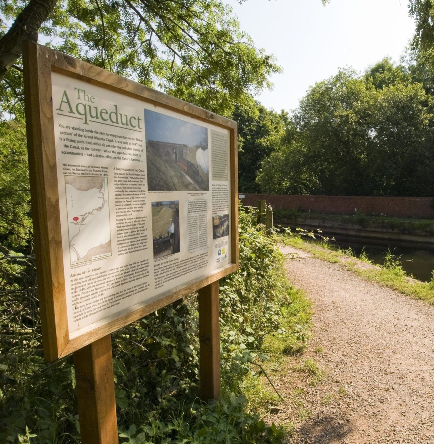
Aqueduct
Aqueduct

To the east of East Manley Bridge is the canal’s only aqueduct, which was built by the Bristol & Exeter Railway Company in 1847. Although he had left the company by the time of its construction, it is believed that Isambard Kingdom Brunel was responsible for the design of the aqueduct. The aqueduct was built to allow the Tiverton branch line to continue however only one of the twin tunnels was ever used, and the railway was closed for passengers service in 1964. The Aqueduct was relined during the winter of 2020/21 and had new fenders fitted.
-
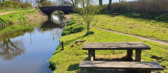
Crownhill Bridge and Picnic Site
Crownhill Bridge and picnic site

Crownhill Bridge was originally named Backlane Bridge or ‘change path’. It’s here that the towpath switches to the other side of the canal and the horses drawing the barges were led over the Bridge to resume their journey along the towpath.
Things to look out for: Crownhill Picnic Site
-
Tiverton Road Bridge
Tiverton Road Bridge

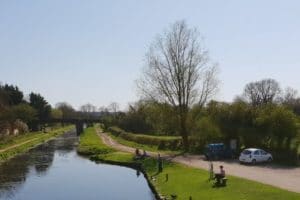
The Country Park’s second busiest car park is located beside Tiverton Road Bridge and gives access to a large bend in the canal known as the Swan’s Neck. A mobile café is based here between April and October each year open at weekends (and some weekdays during school holidays)
Beside Milestone 3 are Tiverton Road Car Park and the Dudley Weatherley Jubilee Bridge. This lift bridge was built in 2002 – the Queen’s 50th jubilee year – and is named after a well-known local artist who was prominent in the campaign to save the canal back in the 1960s and early 1970s. Sadly Dudley died in 2004, but this elegant lift bridge will help to keep his memory alive for generations to come.
The Swans Neck (Tiverton Road Bridge to Greenway Bridge)
For the next mile and a quarter, the canal sweeps out on a large loop above the village of Halberton. When the Canal was constructed, rather than using locks, the canal engineer, John Rennie, felt it was more efficient commercially to construct embankments, cuttings and long bends where necessary to keep the canal on a level contour.
A circular route incorporating this section of towpath and some recently-created paths provide a very pleasant and largely off-road walk. (see Walking page for details). This section is surrounded by farmland and for a few hundred metres on the offside, the Tiverton Golf Club. The area offers some wonderful views across to the Blackdown Hills (an AONB) and the long ridges which characterise the East Devon landscape. There are also good views across to Halberton, featuring St Andrews Church and Halberton Court Farm.
Things to look out for: Milestones, Sellake Bridge,
-
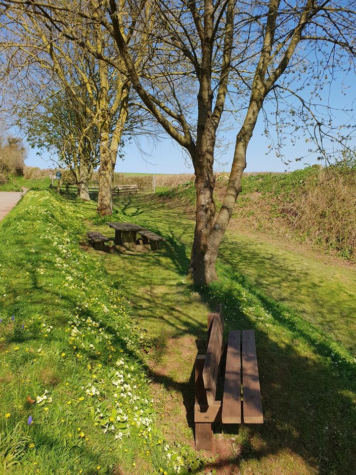
Greenway Bridge and Picnic Site
Greenway Bridge & Picnic Site

After passing through a short, wooded cutting between Greenway Bridge and Swing Bridge, the canal crosses the highest embankment along its length, where fine views of the Blackdown Hills are afforded.
-
Swing Bridge
Swing Bridge
A major breach of this embankment took place during storms and flooding in 2012, but following extensive repairs there is now virtually no evidence of the huge scar on the landscape which was created.

Things to look out for: Swing Bridge, Milestone 5
-
Rock Bridge
Rock Bridge
Just after Rock Bridge is Rock House, built around the same time as the canal for Captain John Twisden – the engineer who succeeded James Green in extending the canal to Taunton. The name ‘Rock’ relates to the fact that the bedrock is very close to the surface at this point, and it was a remarkable achievement for a cutting to be chiselled out by hand through this section by the navvies who built the canal. Equally impressive is the beautiful Oak tree on the offside of the canal near Rock House that has grown to a tremendous size with its roots sprawling over the bedrock.
Things to look out for: Battens Bridge
-
Sampford Peverell
The Canal continues to pass through mixed farmland with outstanding views to the east until it reaches the pleasant village of Sampford Peverell.
Things to look out for: During late spring and summer this area is home to important populations of Reed Warblers and Sedge Warblers who nest in the bankside vegetation.
Sampford Peverell
The canal passes through the centre of Sampford Peverell. The western end of the village is characterised by attractive older buildings and St John the Baptist church.
Things to look out for: St John the Baptist church, The Globe Inn, Landing stage for boats, Sampford Peverell Picnic Site, Sampford Peverell Play Area, and Buckland Bridge.
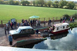
From Buckland Bridge the Canal once again enters a more rural, farmed environment, punctuated briefly by the A361 North Devon Link Road which crosses the canal via the modern concrete Boehill Bridge. Below this bridge is the Boehill Slipway, which was constructed in 2003 to enable trailed boats to visit the canal.

Soon after you will discover Minnows Touring Park located behind a hedge on the towpath side. Followed by Holbrooke Bridge, where the quiet rural feel is restored, with views across to the Blackdown Hills.
Things to look out for: Boehill Slipway
-
Ayshford Chapel
A highlight within this section is the 15th century Ayshford Chapel and 10th century (or earlier) Ayshford Court which are located beside the Canal on the offside. Ayshford Chapel is a former private chapel and is recorded in the National Heritage List for England as a designated Grade I listed building. It is under the care of the Friends of Friendless Churches.
-
Westcott Bridge to Ebear Bridge
 Westcott Bridge is an ‘accommodation bridge’ built to link up farmer’s land that was split by the construction of the canal. This section is usually the best along the canal for spotting dragonflies and damselflies, and an information panel provides details of what you might see and where and when you may see them. An adjacent layby provides easy access to this section which also contains a fishing platform designed for wheelchair/mobility buggy users and a split-level landing stage designed for use by narrowboats on the higher level and canoes and kayaks on the lower level.
 -
Ebear bridge to Fossend bridge

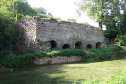
Near milestone 9, this section of the canal crosses the Spratford Stream which is carried under the Canal by the fine, Grade II-listed Twin Culverts. A little further on, on the offside is the tilting weir – a 3m by 1m gate that can be remotely operated, which enables the Canal Ranger Service to manage canal water levels.
When it reaches the village of Burlescombe, the canal passes between a handful of properties dotting the canal banks. Black Bridge is an old mineral line bridge across which limestone was transported to the railway line further up in the village. There is space for several cars to park beside the old wharf and the small picnic area is popular with families feeding the ducks and swans.
Things to look out for: Double culverts, Tilting Weir and Black Bridge
-
Fenacre Bridge to Waytown Tunnel
Here the canal extends through a deep, wooded cutting. With lots of mature trees and crystal-clear waters due to the natural springs which feed the canal, this quieter section of the Country Park has a distinctly different atmosphere. In this section you will also find:

Whipcott Wharf
Which is now used as a picnic site (accessed via steep steps).Waytown Limekilns
The structure reminds us of the canal’s industrial heritage, as a nearby information panel tells the story with an artist’s impression of what it might have been like in the Canal’s heyday when limestone was being burnt in the kilns to use as a fertiliser on local farmland.Waytown Tunnel
Immediately after the kilns, the towpath heads unexpectedly uphill, over Waytown Tunnel, crossing a minor road and re-joining the towpath on the other side. -
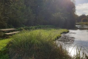
Lowdwells Lock Lowdwells Lock is at the north eastern end of the Grand Western Canal Country Park. The gates have been removed and the centre of the lock has been filled in to provide a bund across the canal, and access to the picnic site on the opposite bank.
The lock marks the end of the in-water section of the Grand Western Canal and from here the canal originally crossed over the road via an aqueduct and continued towards Taunton, where it joined the Bridgwater and Taunton Canal. However, this section was abandoned in the mid 1800s due to the success of the railways, although most of the former towpath remains a public right of way and some of the original features are still present. To access this public right of way, continue down the road, on your left is a small car park and in front of you is a gate/style, from this point you can trace the former route of the canal for 5 ½ miles to the remains of Nynehead Lift near Wellington along a public footpath that follows the original towpath.
Alternatively, there is also a pleasant circular walk from Lowdwells that follows part of the original route, taking in several historic features of the canal and some lovely countryside with a pub halfway round – Lowdwells to Appley Circular Walk.
 Lowdwells Lock is at the north eastern end of the Grand Western Canal Country Park. The gates have been removed and the centre of the lock has been filled in to provide a bund across the canal, and access to the picnic site on the opposite bank.
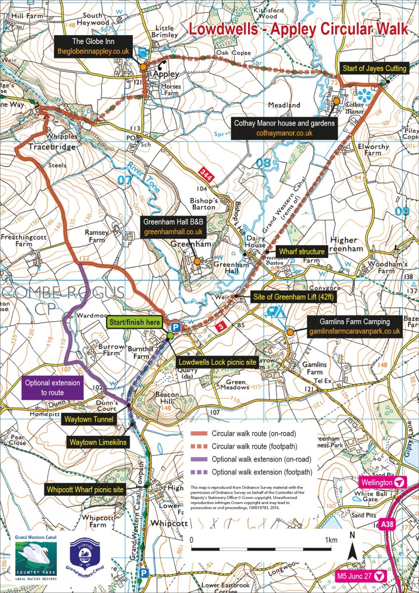