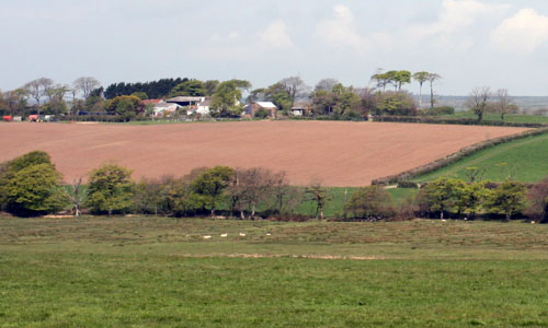
This is an elevated, expansive landscape forming a series of ridges, with long views from high ground. Dartmoor provides a backdrop to the southern part of the area; the sea forms the horizons from the north. There are extensive areas of Culm grassland, which can feel bleak and exposed, but are rich in prehistoric archaeology and of international importance for their biodiversity. Some areas of the Culm grassland have been planted for forestry, and the dark colours and abrupt edges of the large conifer plantations contrast with the softer deciduous vegetation in the valleys. The farmed landscape of the valleys has a much softer texture and a more settled ‘working’ character than the Culm grasslands of the moors above. It includes pastoral fields, scattered whitewashed farms and occasional larger settlements such as Bradworthy and Holsworthy.
- Context
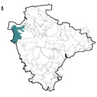
 This extensive area is located on the western edge of Torridge District, and comprises elevated upland farmland and Culm grassland. Its western boundary is defined by the county boundary with Cornwall. To the north are the Hartland Peninsula and the Bideford Bay Coast, where the landscape changes from grassland and plantation to more intensive agricultural use and coastal influences become stronger. To the east is the more incised landscape of the Western Torridge Upland Farmland; while to the south there is a gradual transition into the High Torridge Culm Plateau and the Upper Tamar Tributary Valleys.
 - Constituent Landscape Character Types
Constituent LCTs:1F: Farmed Lowland Moorland and Culm Grassland, 5A: Inland Elevated Undulating Land, 3C: Sparsely Settled Farmed Valley Floors, 3H: Secluded Valleys
Part of NCA:149: The Culm - Distinctive Characteristics
- Underlying geology of Culm Measures, comprising smooth banks of mudstones and siltstones, and harder outcrops of sandstone which create broad ridges.
- Elevated, open land cut by a series of tributaries which form folds in the landform.
- Tributary valleys with broadleaved and wet woodlands lending contrasting shelter and texture; extensive conifer blocks on upland areas; avenues of mature beech on summits and along roadsides.
- Generally poor, acidic, ill-drained soils, parts of the area having a farmed character, with fields grazed by cattle and sheep, while others have rough, unimproved Culm grasslands and rushy meadows.
- Medium-scale regular fields of recent enclosure on higher ground; pockets of smaller fields of medieval origin on valley slopes.
- Field enclosure by mixed-species hedges, with flower-rich banks and hedgerow trees in sheltered locations and tracts of unenclosed rough grazing along valley bottoms and on upland Culm grassland areas; locally-distinctive hedges topped with gorse and beech around Holsworthy.
- Extensive Culm grasslands in the north and south of the area supporting diverse range of species including ground-nesting birds and marsh-fritillary butterfly; also botanically-rich fen and rush pasture, valley mire, unimproved wet grassland and riparian/ valley-side woodland.
- Scattered archaeological features, including clusters of Bronze Age bowl barrows on summits, possibly part of a wider prehistoric landscape incorporating Clovelly Dykes.
- Farms often sited on exposed ridges with shelter planting, while nucleated villages tend to occupy prominent ridgeline positions with linear development often spreading out from the historic core.
- Local vernacular of white-washed or local sandstone buildings, often with red brick detailing, and with slate or thatched roofs.
- Square church towers with ornate pinnacles that form distinctive local landmarks (e.g. Bradworthy).
- Locally distinctive linhays (livestock shelters) of local stone and cob.
- Straight roads traversing ridges and dipping down into valleys, crossing streams on sandstone bridges, with white finger posts at road junctions.
- The northern part of the area has views to an open seascape, including the island of Lundy on the horizon.
Evaluation
- Special Qualities and Features:
- Long views from high ground across open landscapes to the sea in the north and Dartmoor and Bodmin Moor in the south.
- Sense of remoteness, particularly in Culm grassland areas, and away from main roads.
- Relatively high levels of tranquillity in the central and northern parts of the area, and dark night skies beyond the influence of Holsworthy.
- Culm grasslands, including Bursdon Moor, Thorne Moor, Dunsdon and Bradworthy Common are internationally valued as part of the Culm Grasslands SAC; also several Culm grassland SSSI and CWS sites and NNR at Dunsdon, providing public access and interpretation of this important habitat.
- Northern part of the area within the North Devon Biosphere Reserve covering the Taw and Torridge river catchments.
- RIGS site covering geological exposure near Bradworthy.
- Numerous prehistoric barrow sites are SMs.
- Conservation Areas covering the historic cores of Holsworthy, Bradworthy and Buckland Brewer.
- Some areas of access land on commons and in plantations.
Forces for Change and Their Landscape Implications:
- Past and Current
- Fragmentation of Culm grassland habitats due to agricultural improvement and drainage, and planting of forestry plantations.
- Poor management of remaining Culm grassland areas, including under-grazing leading to scrubbing up and over-grazing leading to a uniform grass sward.
- 20th century planting of conifer plantations within the open landscape, and decline in levels of woodland management in the area’s broadleaved woodlands.
- Agricultural intensification and amalgamation of farm units into larger, more viable holdings.
- Localised loss or poor management of traditional landscape features such as hedgerows and linhays.
- Introduction of new elements into the landscape, including reservoirs in the Tamar Valley and farm diversification schemes such as fisheries, campsites and riding centres.
- Prominent pylon lines, wind turbines near Bradworthy, industrial developments outside Holsworthy and busy roads including the main A388 and A39 that locally dilute the landscape’s strongly rural character.
- Increase in visitor, farm and industrial traffic on the rural road network.
- Future
- Uncertainly over future levels of agricultural grants and funding, potentially affecting farm viability and the repair of landscape features such as hedgerows and linhays.
- Increasing demand for commercial wind farms on the high open ridges.
- Development pressure (housing, commercial and industrial) around the main settlements.
- Increase in tourism and recreation, and continued farm diversification to cater for the required facilities, potentially changing the character of the landscape and reducing its tranquillity.
- Climate change affecting weather patterns, storm frequency and growing seasons, in turn affecting farming practices and the species composition of Culm grasslands.
- Felling and replanting of forestry plantations as they reach maturity.
- Potential changes in species composition of broadleaved woodland as a result of new pests, diseases and changing climatic conditions.
Strategy
- Overall Strategy
To protect and manage the open, rural qualities of the landscape, the valuable Culm grassland habitats, and agricultural landscape features. The locally-distinctive features of the landscape are protected and restored where necessary. The area’s Culm grasslands are well-managed, restored and linked to maximise their biodiversity. Sustainable agriculture is supported and the agricultural landscape is in good condition. Plantations and woodlands are well managed, and sustainable levels of recreation and access to the countryside are encouraged.
Guidelines:
- Protect
- Protect locally-distinctive built features such as linhays, sandstone bridges and white finger-posts; ensure that any new building respects local vernacular styles (whilst incorporating sustainable design).
- Protect (and appropriately manage and interpret) the prehistoric archaeology of the area.
- Protect valuable Culm grassland habitats, and do not allow further loss to agriculture or forestry
- Protect the area’s rural quality and openness, avoiding poorly-sited development.
- Manage
- Manage Culm grassland and wetland habitats (with locally-appropriate levels of grazing) to maximise their biodiversity and strengthen their resilience to climate change.
- Manage areas within the North Devon Biosphere Reserve in accordance with management guidelines.
- Manage forestry plantations for sustainable timber production and to enhance their wildlife interest. Explore the potential for community use of woodfuel as a sustainable resource, and the use of plantations as recreational sites, reducing visitor pressure on more sensitive Culm grassland habitats. Consider softening the edges of plantations with native broadleaved species.
- Manage the area’s varied hedgerows and hedgebanks, retaining local diversity.
- Plan
- Plan to link fragmented areas of Culm grassland to improve habitat connectivity.
- Plan for the long-term reversion of prominent conifer plantations to open habitats on maturity and felling, including re-creation of Culm grassland and other semi-natural habitats within open rides and on wet ground.
- Plan to increase levels of accessibility of the countryside through enhancement of the public rights of way network, particularly around larger settlements.